Balliol College Archives & Manuscripts |
Back to: HOME > Archives and Manuscripts > Exhibitions Index
Conservation of Maps
 This exhibition is a web version of one put on for all Fellows in the SCR lounge between College Meeting and Consilium Dinner on Wednesday 14 February 2007, and displays some of the first fruits of Balliol's membership of the Oxford Conservation Consortium.
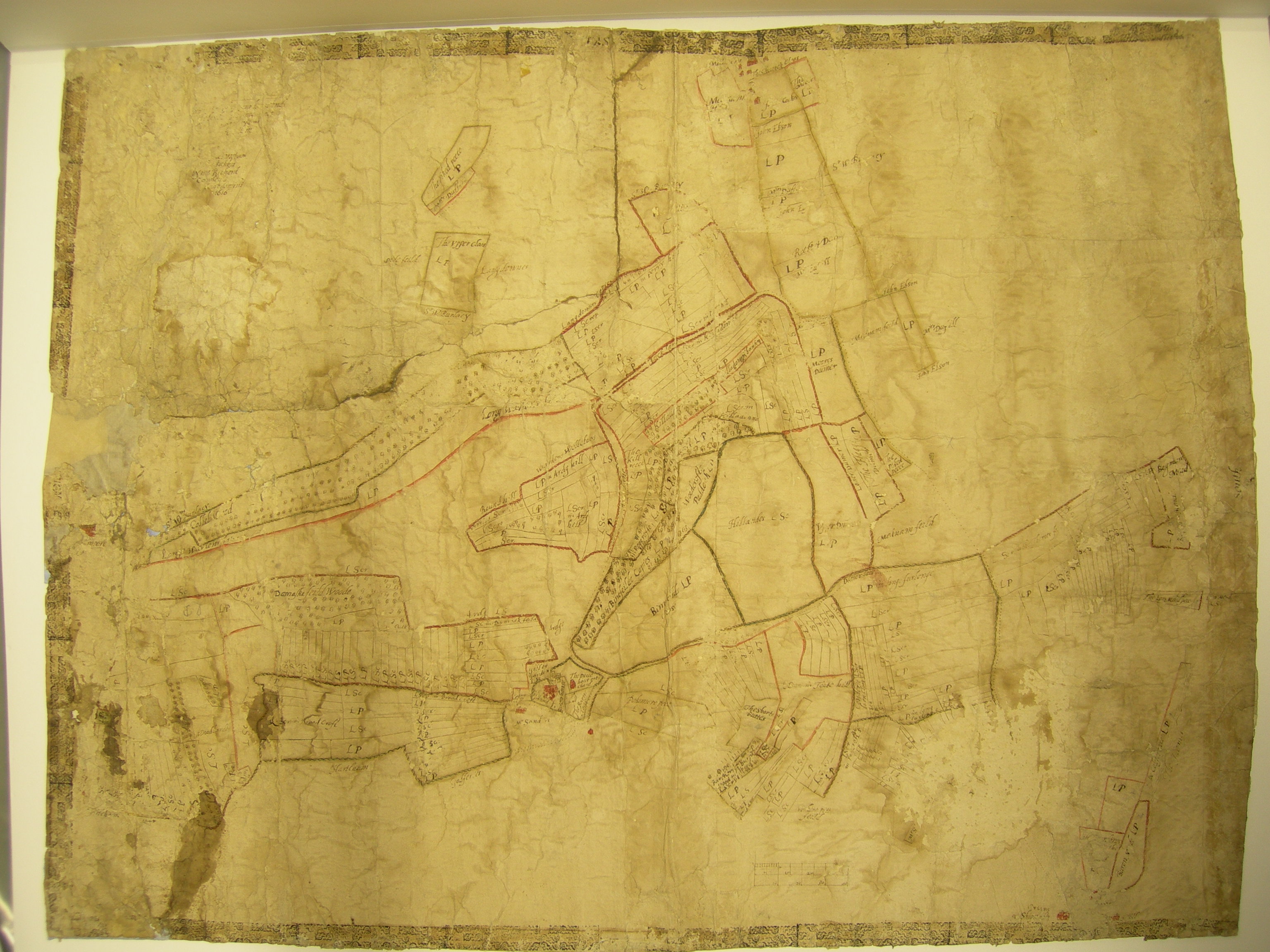
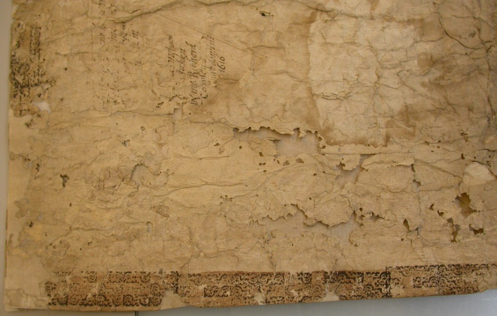
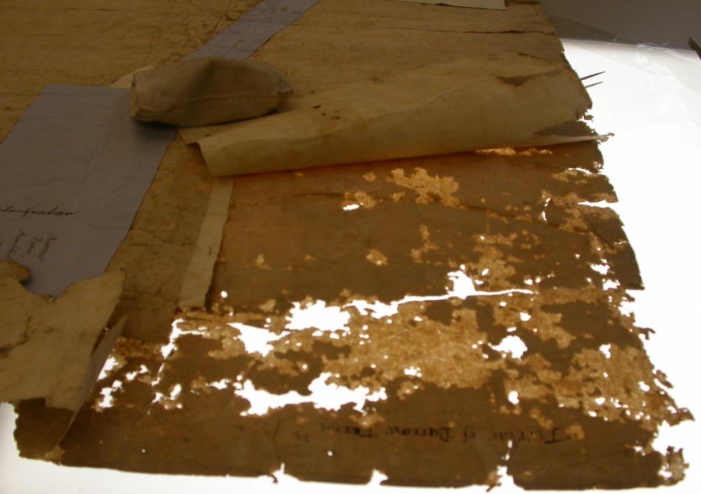
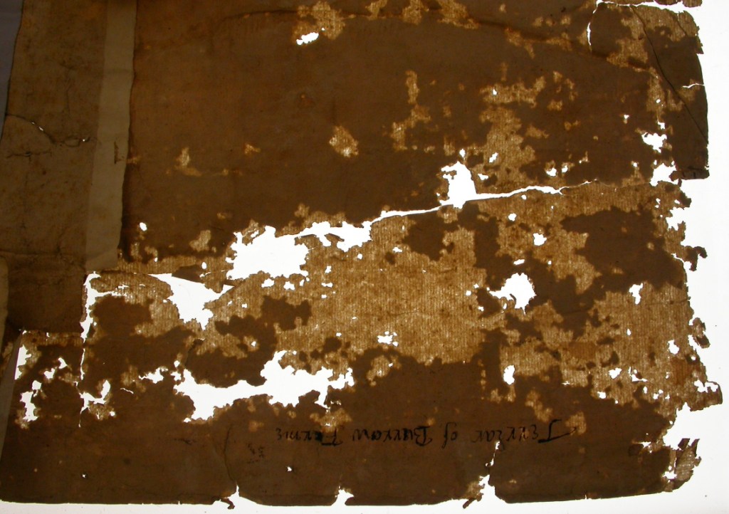
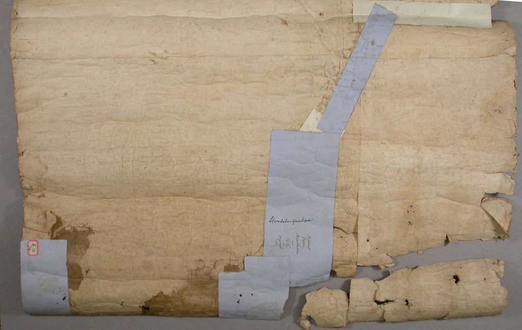
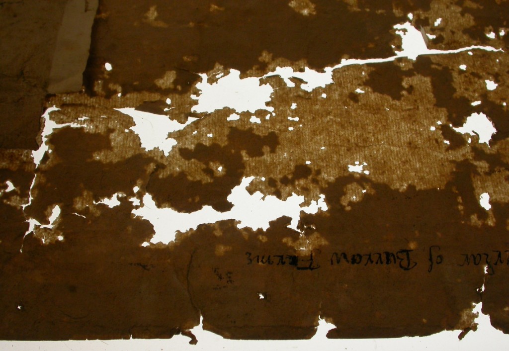
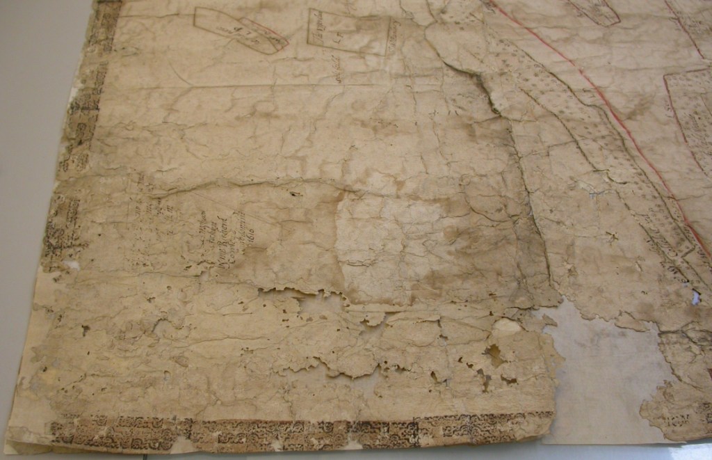
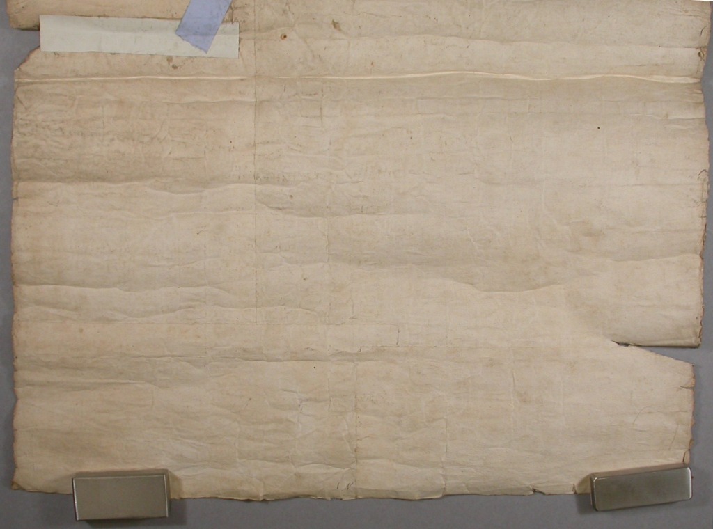
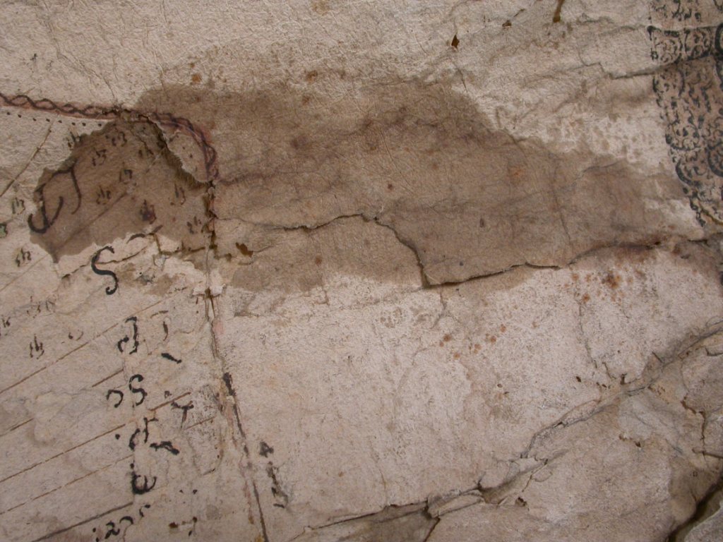
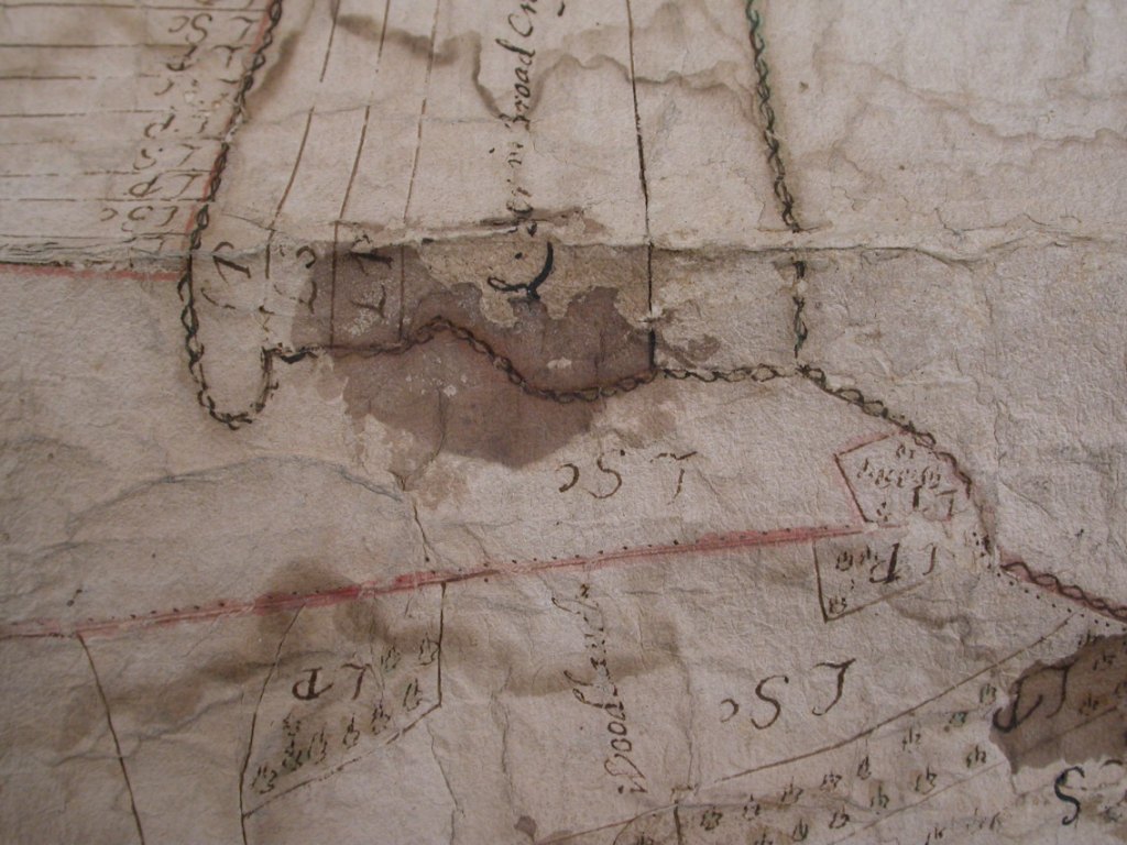
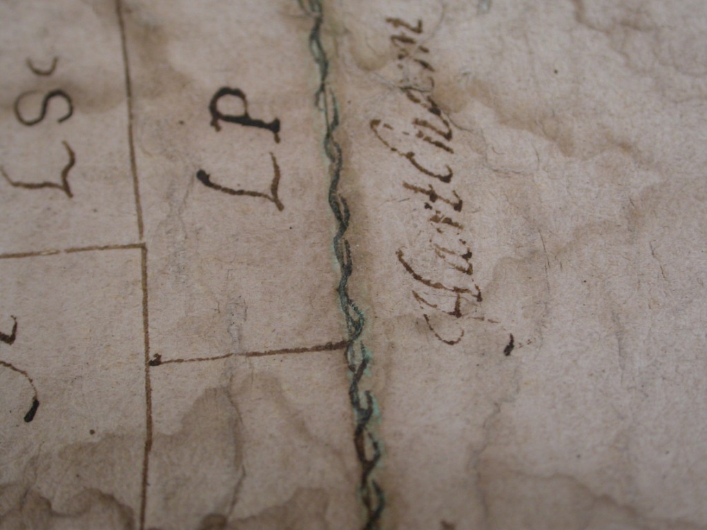
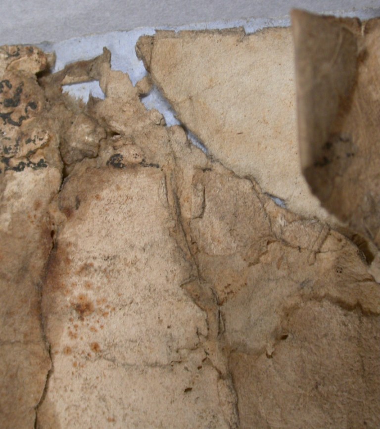
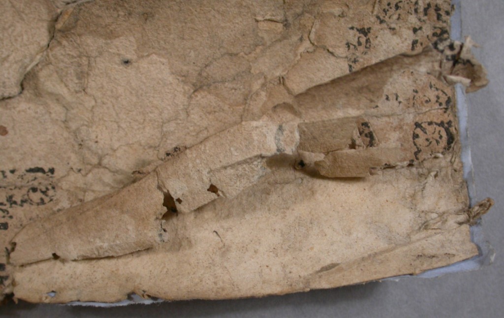
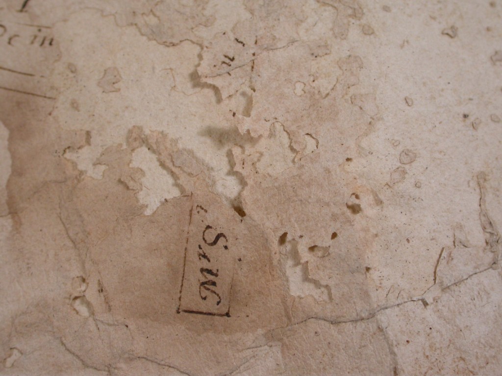
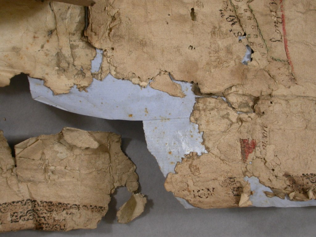
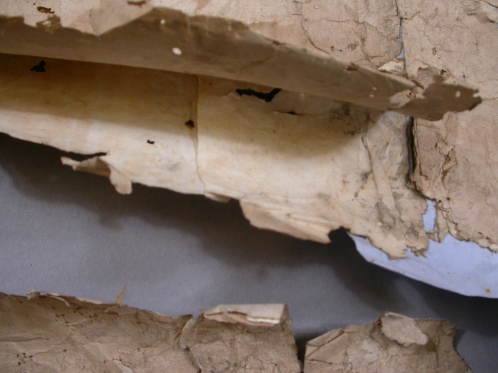
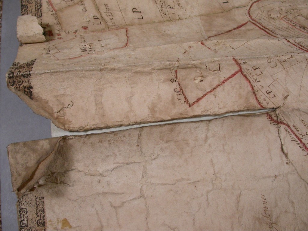
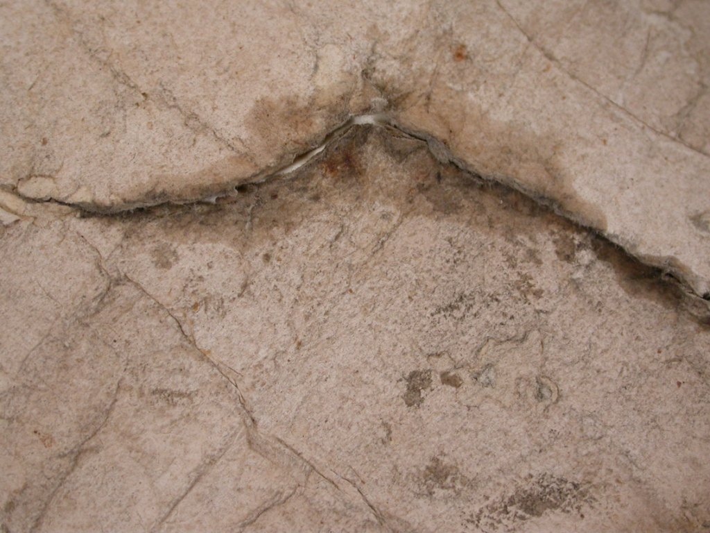
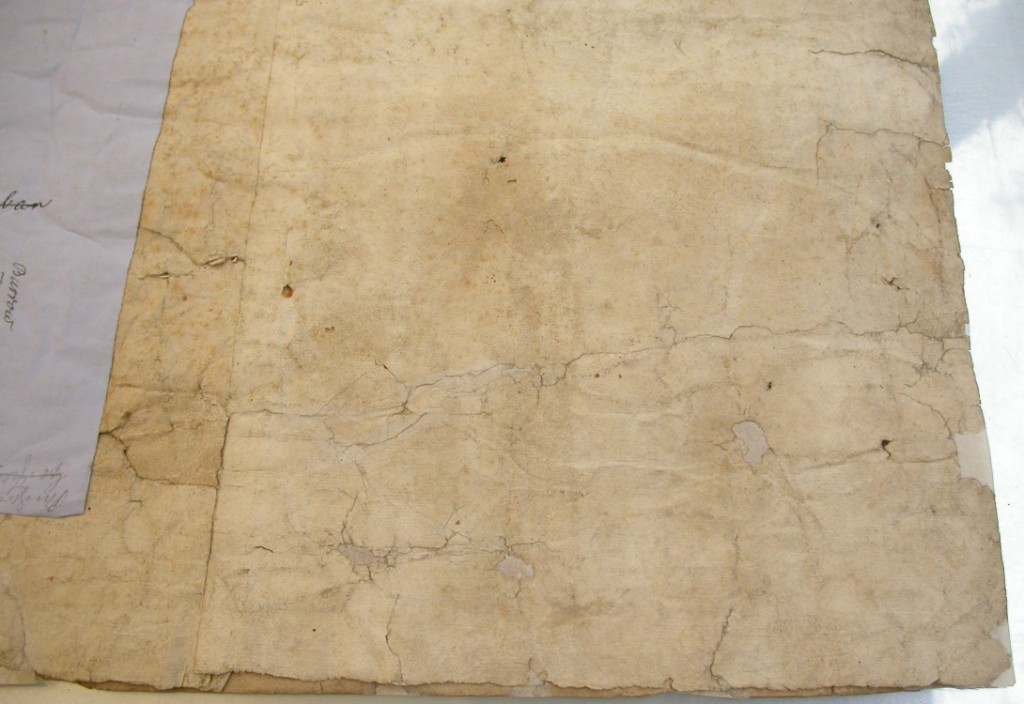
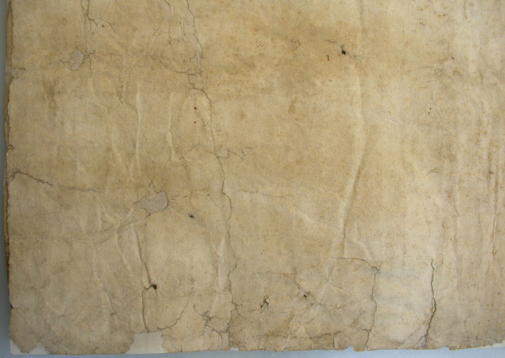
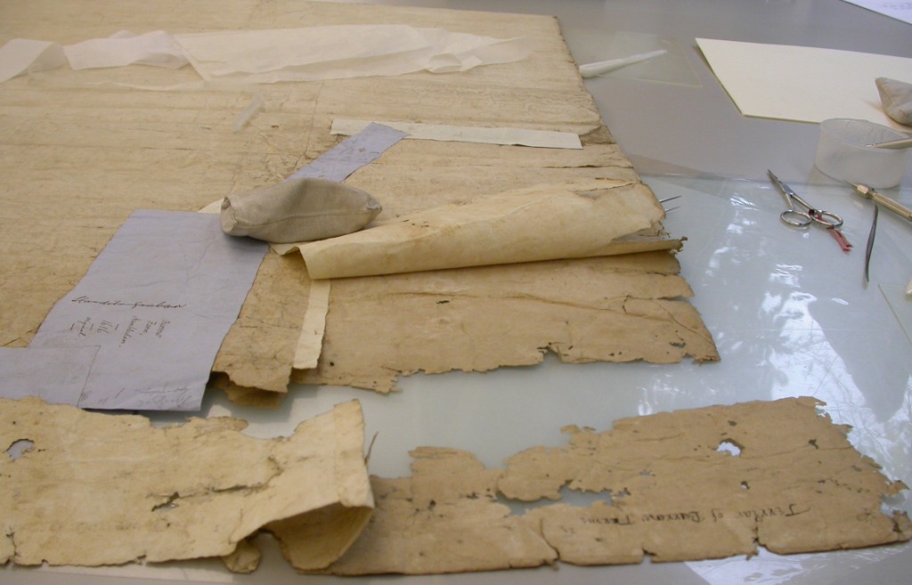
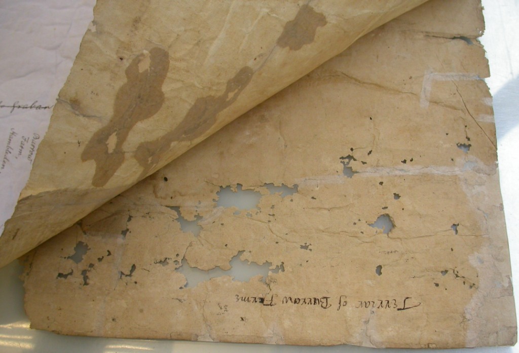
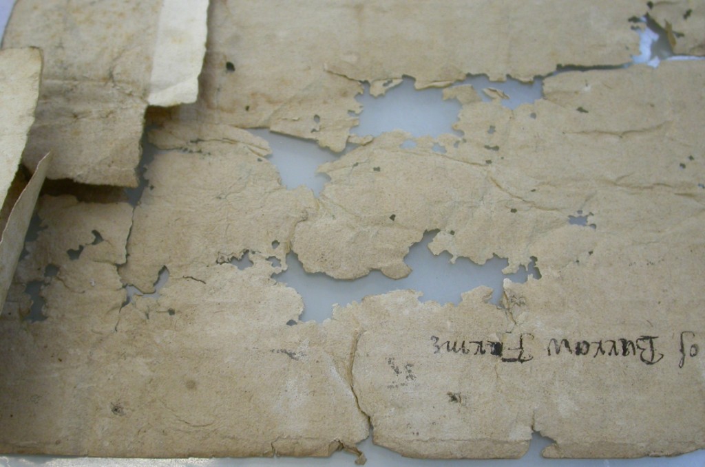
 Balliol joined the Consortium in October 2006, and our first batch of work has recently come back from the conservation studio. Head conservator Jane Eagan and her team were working on a number of maps on paper, parchment and linen from the Archives. They have all been cleaned, flattened and repaired. Many of these maps have not been looked at for years, simply because they were badly soiled with soot from the old Bursary fireplaces and tightly rolled, making them awkward and unpleasant to work with. E.11.10 was in very poor physical condition and is a particularly vivid example of the kind of work the conservators can do. All the conserved maps are now in a fit state to be safely produced for researchers. They have been photographed for the purposes of documenting the work done, and can be photographed in greater detail for researchers, particularly those unable to visit Oxford in person.
The maps
Repairs - before and after
The exhibition
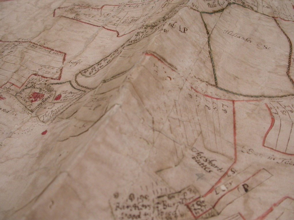
The maps
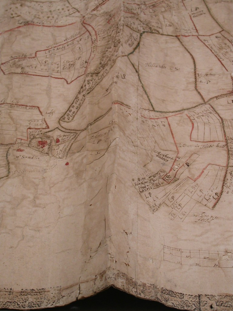
These are a selection of Balliol's oldest maps. Although the college archives hold records relating to all its former properties, Balliol College no longer owns any of the lands depicted on these maps, or any properties other than its Oxford premises.Click on highlighted place names in the descriptions to see the present-day location on Google Maps.
 |
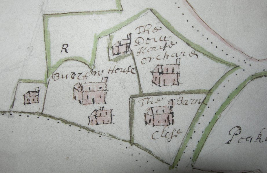
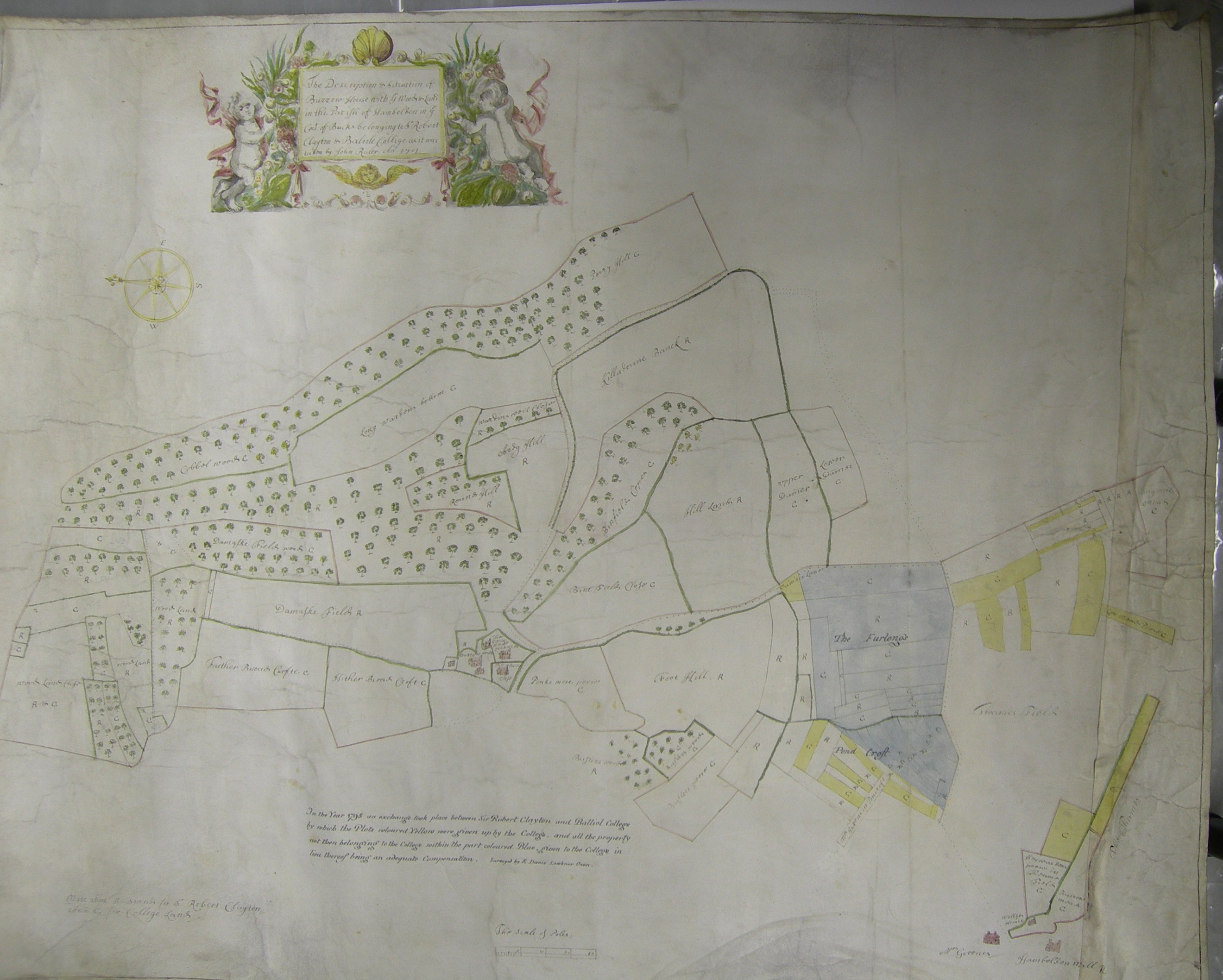
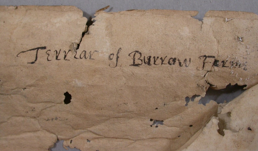
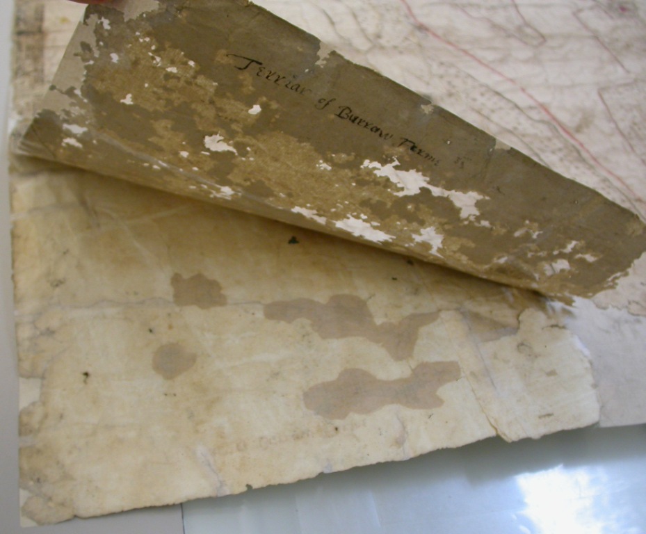
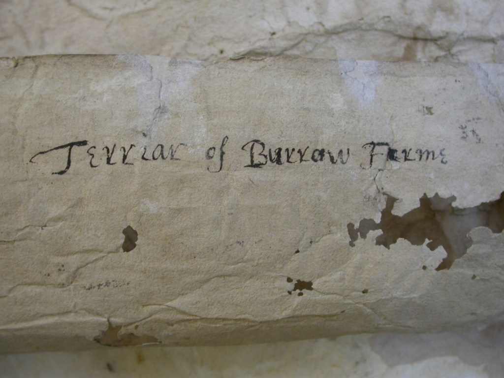
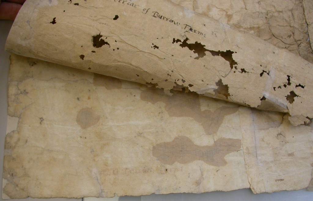
1616 Map of Burrow Farm, Hambleden (E.12.74) |
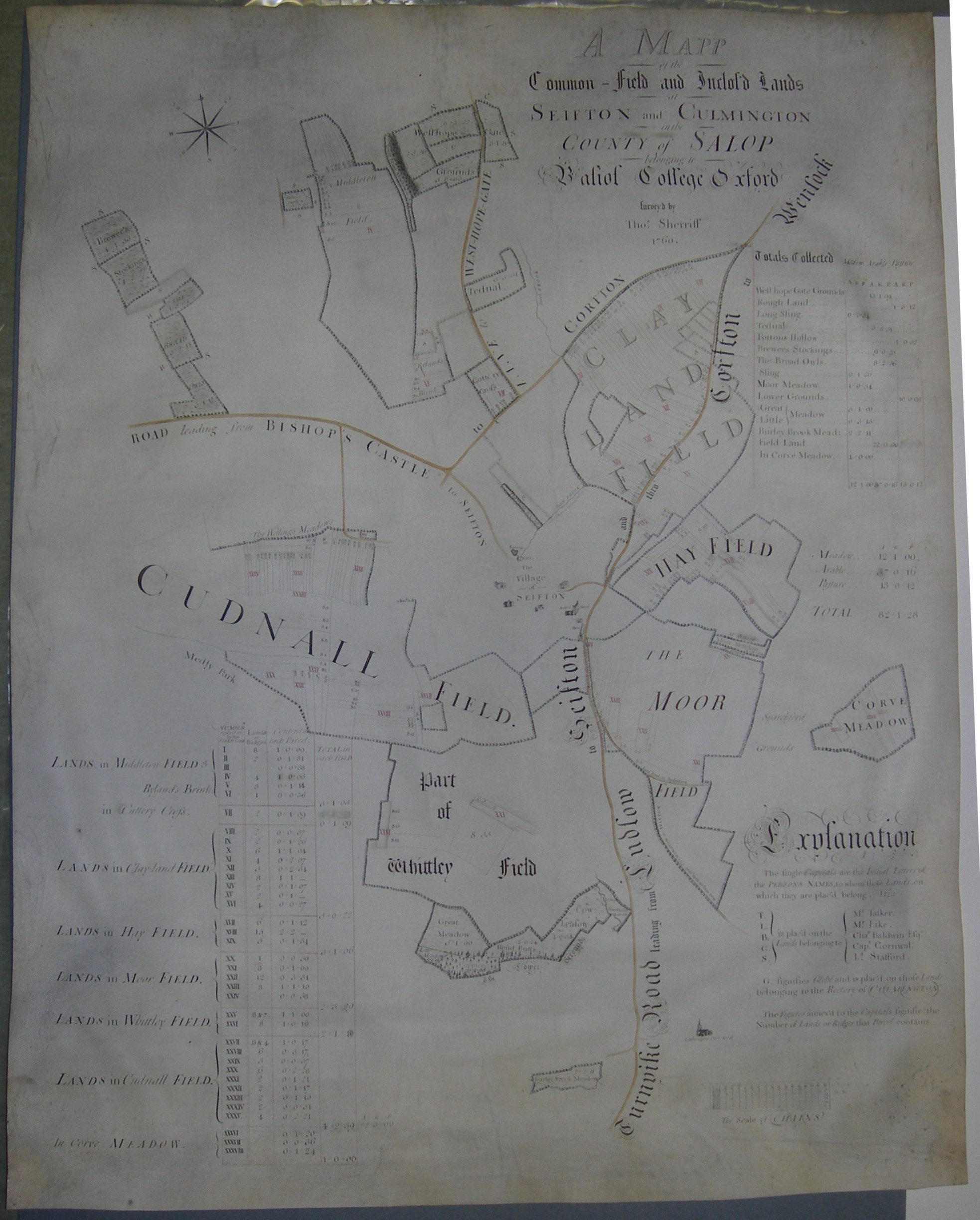 |
1760 A Mapp of the Common-Field and Inclos'd Lands at Seifton and Culmington in the County of Salop belonging to Balliol College, Oxford. Survey'd by Thomas Sheriff, 1760. (Estate Maps 11) |
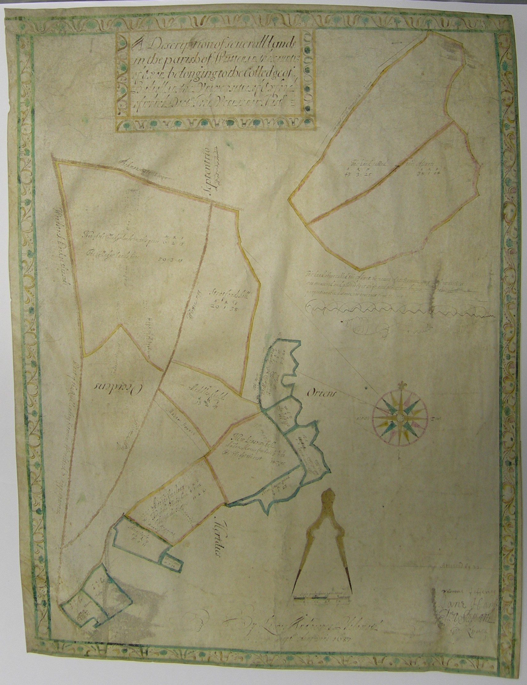 |
1687 A Description of several lands [Old Woodstock] in the Parish of Wootton in the County of Oxon belonging to the College of Baliol in the Universitie of Oxford of which Doctr. John Venn is now Master. By Lewis Andrewes, Philomath. Sept. 1687 (E.11.4) |
 |
1767 Plan of Balliol lands at Longbenton. (E.2.59) |
 |
1701 Map of Burrow Farm, Hambleden (E.12.75) |
 |
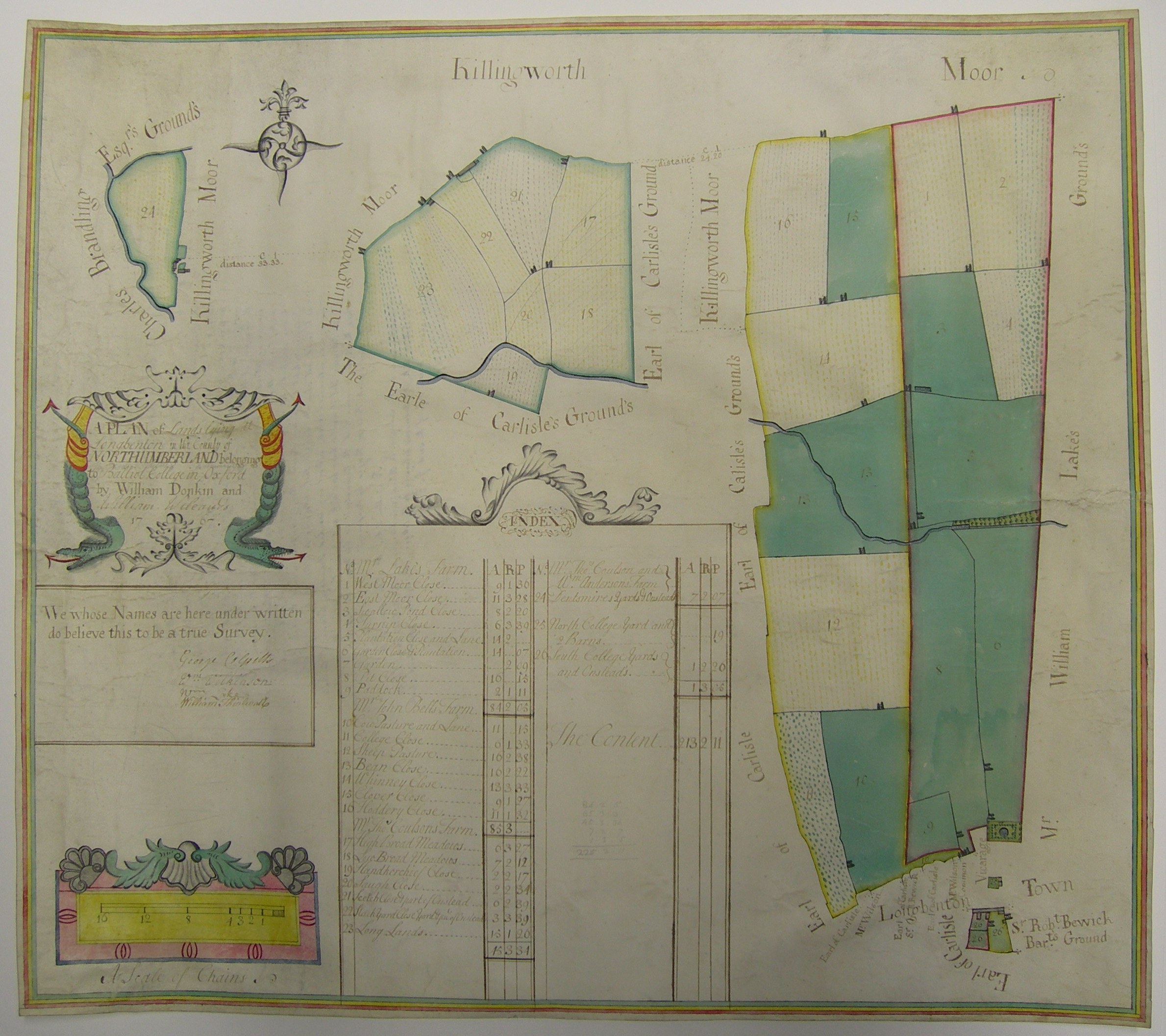
1767 A Plan of Lands lying at The Heugh and Stamfordham in the County of Northumberland belonging to Balliol College in Oxford by William Donkin and William Weleand. (E.11.) |
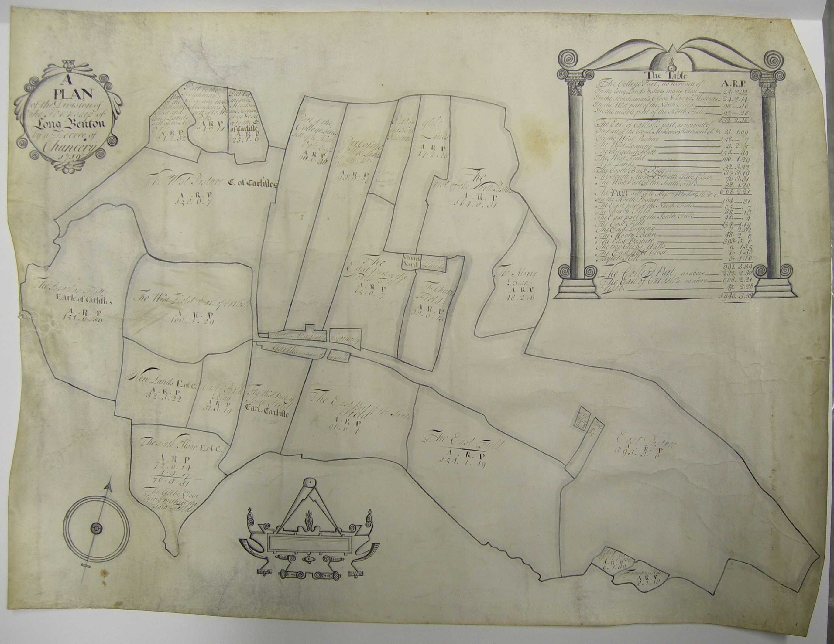 |
1719 A Plan of the Division of the Township of Long Benton by a Decree of Chancery. (E.2.58) |
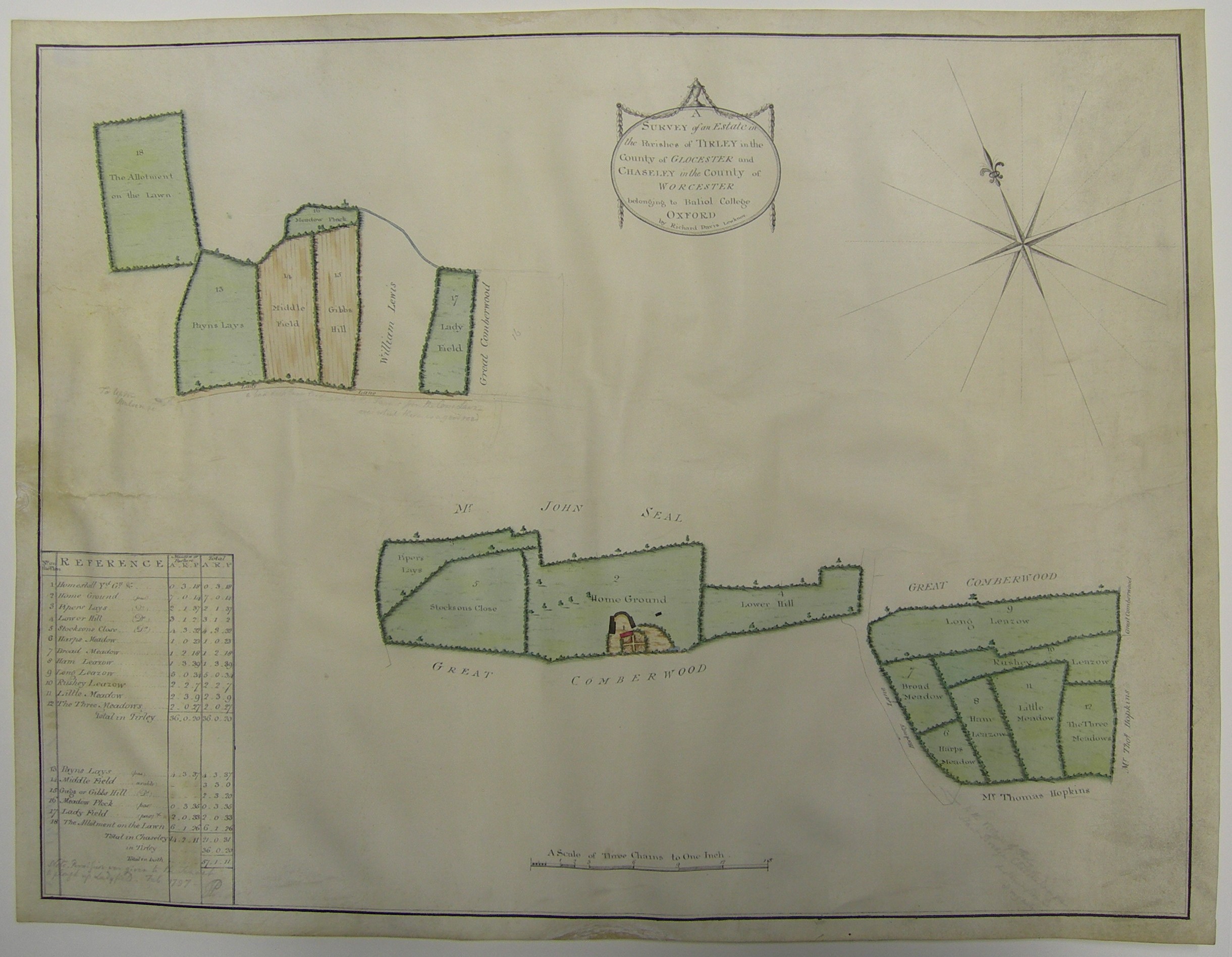 |
ca 1780 Map of Great Cumberwood estate (F.2.37), in the parishes of Tirley, Gloucs and Chaceley, Worcs |
Repairs - before and after
 |
 |
 |
 |
 |
 |
 |
 |
 |
 |
 |
 |
 |
 |
 |
 |
%20of%20E.11.10-19%20join.jpg) |
%20of%20E.11.10-3.jpg) |
%20of%20E.11.10-4.jpg) |
%20of%20E.11.10-4a.jpg) |
%20of%20E.11.10-5.jpg) |
 |
 |
 |
 |
 |
 |
 |
 |
 |
 |
 |
 |
All images in this section were taken by Jane Eagan and are copyright the Oxford Conservation Consortium. Images are used by kind permission of the Oxford Conservation Consortium. They may not be downloaded or otherwise reproduced in any way without written permission.
The exhibition
As laid out in the SCR. A drinks party is not the ideal place to display old maps, but they were all put in melinex sleeves and everyone was careful with their glasses. No mishaps. I would have liked to use
|
|
|


You do not need to request permission to download or print one copy of any of the images on these pages for your personal private study or research purposes.
You do need to request permission in writing to use any of these images for any publication in any format, including any use on a website.
There is no charge for Archive enquiries, but donations for Archive purposes are always appreciated.
| Updated 11.viii.14
|
Balliol College All rights reserved © 2026 |